
Features
Details
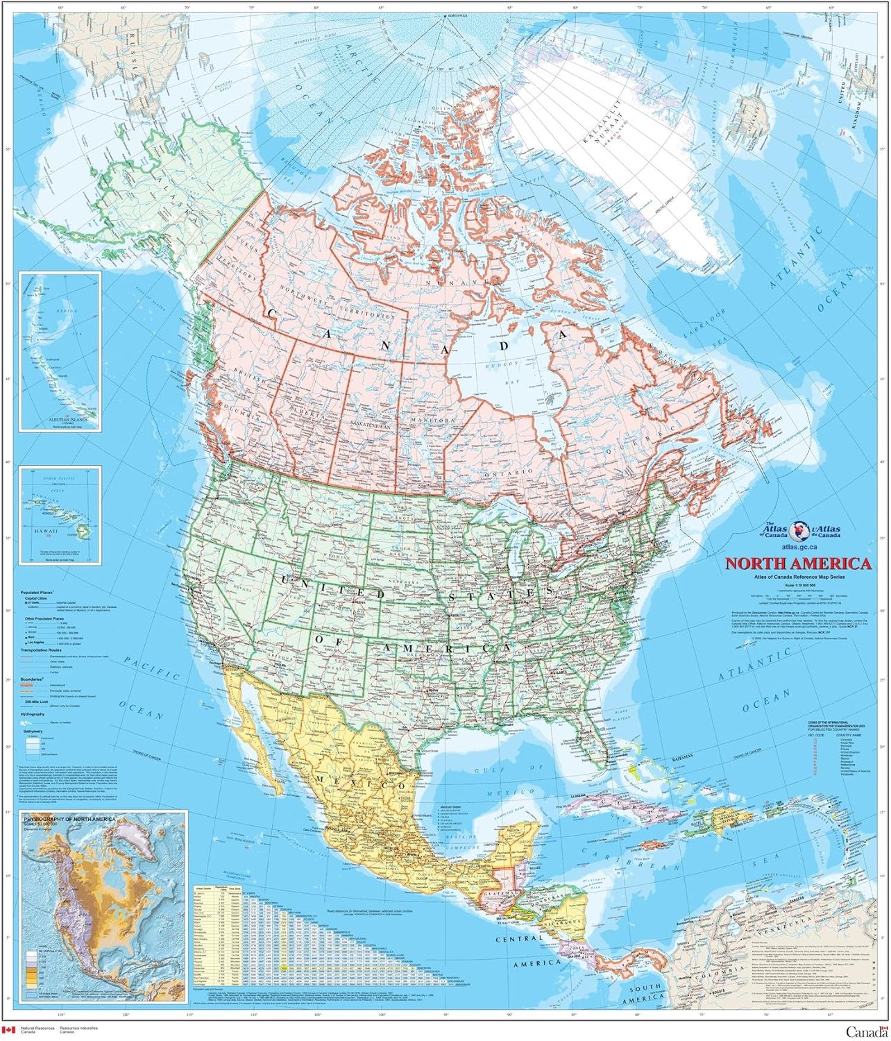
Looking to explore North America? Look no further than our North America Wall Map - Atlas of Canada. This meticulously crafted map is your ultimate guide to the vast continent, with detailed coverage of populated places, transportation routes, and the drainage network. With a scale of 1:10,000,000, you can trust this map to provide accurate and reliable information for all your adventures.
What sets this map apart is its laminated design. This means it's not only durable but also resistant to water and tears. No matter where your travels take you, this map will withstand the test of time, ensuring you have a trustworthy companion with you every step of the way. And with its convenient size of 34" x 39", it's easy to pack and carry, making it an essential tool for any traveler.
Our North America Wall Map also features additional insets, showcasing the Aleutian Islands (Alaska), Hawaii, and the North America relief with significant mountain elevations. These insets provide a deeper insight into these regions, allowing you to plan your journeys with precision.
But that's not all! This map also includes a table of road mileages between major cities, helping you plan your road trips and explore the continent's vast wonders. Whether you're embarking on a cross-country expedition or a local getaway, this map will be your invaluable resource.
Don't miss out on the opportunity to enhance your travel experiences with the North America Wall Map - Atlas of Canada. Order yours today and start exploring North America like never before!
Discover More Best Sellers in Maps
Shop Maps
Rand McNally Easy to Read: Wisconsin State Map
 Maps - Rand McNally Easy to Read: Wisconsin State Map

Rand McNally Easy to Fold: New England Laminated Map
Maps - Rand McNally Easy to Fold: New England Laminated Map

Wall Pops WPE99074 World Dry Erase Map, Multicolor
Maps - Wall Pops WPE99074 World Dry Erase Map, Multicolor

Rand McNally State Maps: Louisiana and Mississippi (2 Maps)
Maps - Rand McNally State Maps: Louisiana and Mississippi (2 Maps)

Cool Owl Maps Mexico, Central America, and Caribbean Wall Map - Rolled Laminated (32"x24")
Maps - Cool Owl Maps Mexico, Central America, and Caribbean Wall Map - Rolled Laminated (32"x24")

 Maps - Gifts Delight Laminated 36x24 Poster: Road Map - in high- Highways map of The USA. The USA Highways map in high- Vidiani

Cool Owl Maps New York State Wall Map Poster Rolled 24"Wx30"H (Laminated)
Maps - Cool Owl Maps New York State Wall Map Poster Rolled 24"Wx30"H (Laminated)

Teacher Created Resources Travel The Map Labels Magnetic Accents, Pack of 20
 Maps - Teacher Created Resources Travel The Map Labels Magnetic Accents, Pack of 20