
Features
Regularly updated, full-color maps
Clearly labeled Interstate, U.S., state, and county highways
Indications of parks, points of interest, airports, county boundaries, schools, shopping malls, downtown & vicinity maps
Easy-to-use legend
Copyright 2024
Coverage Area Communities Included: Bartow County, Chereokee County, Clayton County, Cobb County, Douglas County, DeKalb County, Fayette County, Floyd County, Fulton County, Gordon County, Gwinett County, Hall County, Henry County
Discover More Best Sellers in Maps
Shop Maps
The Ballad of the Sad Café: Carson McCullers (Little Clothbound Classics)

 Maps - The Ballad of the Sad Café: Carson McCullers (Little Clothbound Classics)


Never Split the Difference: Negotiating as if Your Life Depended on It
 Maps - Never Split the Difference: Negotiating as if Your Life Depended on It
 Maps - Conquest Maps World Map Poster Modern World Map Style Decor to Track Your Travels & Pin Your Adventures! Matte Poster Paper Detailed Graphics -Cities States & Countries - 2015 Data (48 x 32 Inches)
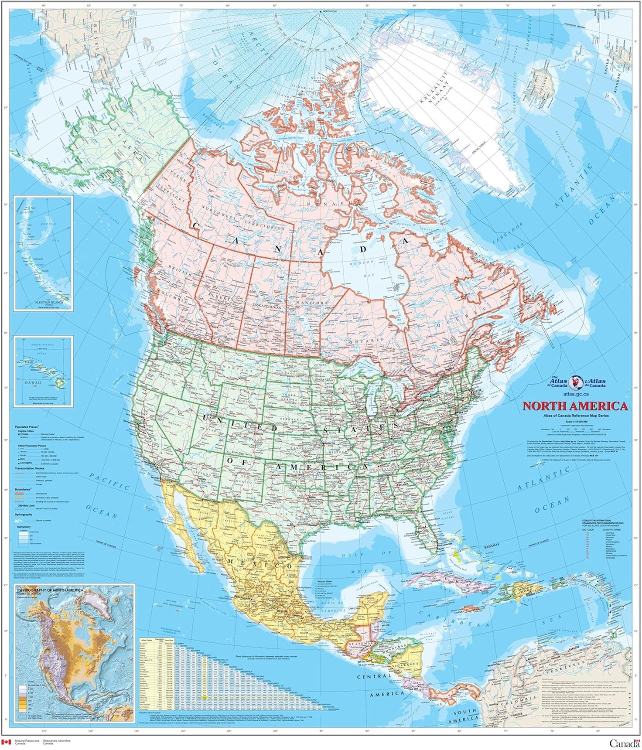
North America Wall Map - Atlas of Canada - 34" x 39" Laminated
Maps - North America Wall Map - Atlas of Canada - 34" x 39" Laminated
 Maps - National Parks Map Poster with 600+ NPS Site and USA Travel Destinations - Slate Edition (24W x 18H inches)

 Maps - World Map Poster with Country Flags - 48x24 Inches Political Country Flags Home Wall Map Picture Home Decor Globe Atlas Earth Geography Mural

Cool Owl Maps Mississippi State Wall Map Poster Large Print Rolled 24"Wx32"H (Paper)
Maps - Cool Owl Maps Mississippi State Wall Map Poster Large Print Rolled 24"Wx32"H (Paper)

