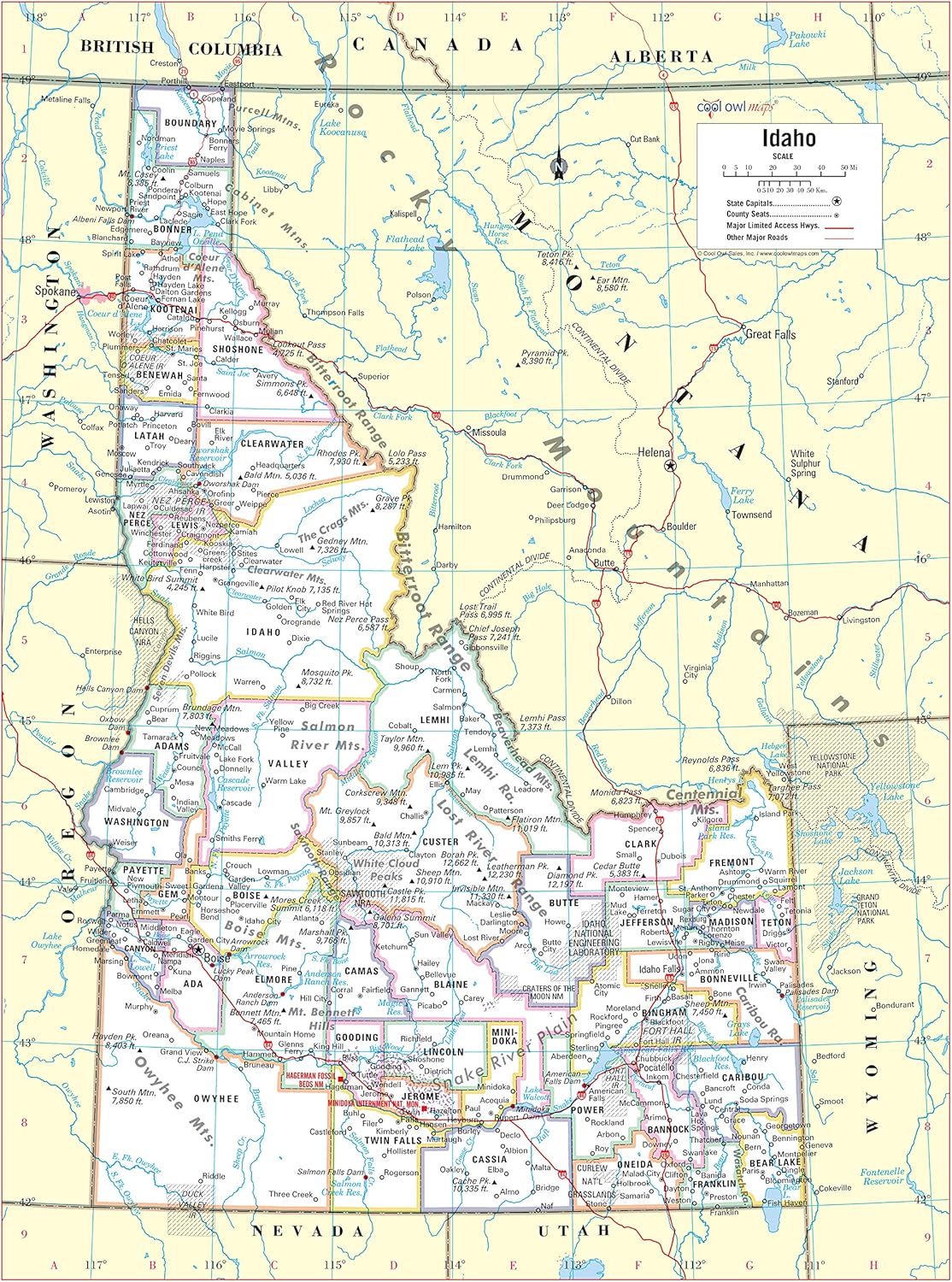

Features
- Large Print for easy reading
- Major Geographical features
- All counties and their capitals
- Size 24"W x 32"H inches (paper or laminated)
- Made/printed in U.S.A. 2019
Details
Looking for a visually appealing and informative map poster? Look no further! Cool Owl Maps presents the Idaho State Wall Map Poster - the perfect addition to any home or office space. With its large print and easy-to-read design, this map ensures that you won't miss a single detail. Whether you're a geography enthusiast or simply want to explore the state of Idaho, this map is your ultimate guide.
Our Idaho State Wall Map Poster showcases all major geographical features, providing you with a comprehensive view of the state's topography. From mountains to rivers, lakes to valleys, this map covers it all. Whether you're planning a hiking trip or studying geography, this map is an essential tool to have at your disposal.
We understand the importance of accuracy, which is why our Idaho State Wall Map Poster includes the names and locations of all counties and their respective capitals. Stay informed and navigate your way through the state with ease. This map is not only informative but also visually stunning, featuring vibrant colors and a high-quality design that will enhance the aesthetic appeal of any room.
The Idaho State Wall Map Poster measures 24" in width and 32" in height, making it the perfect size to hang on your wall. Choose between the paper or laminated option based on your preferences. Our map is proudly made and printed in the U.S.A., ensuring the highest quality and supporting local businesses. Stay up to date with the latest map data with our 2019 edition.
Don't miss out on this opportunity to own the ultimate Idaho State Wall Map Poster! Click here to order now and embark on your journey of exploration and knowledge.
Discover More Best Sellers in Maps
Shop Maps
Gallopade Publishing Group North Carolina State Map for Students - Pack of 30 (9780635106605)

 Maps - Gallopade Publishing Group North Carolina State Map for Students - Pack of 30 (9780635106605)
 Maps - National Geographic United States Wall Map - Classic (43.5 x 30.5 in) (National Geographic Reference Map)

3D Bible Israel Relief Map Scientific Computer Raised (without frame) 47" X 21.5"
Maps - 3D Bible Israel Relief Map Scientific Computer Raised (without frame) 47" X 21.5"
 Maps - United States (USA) and Americas-Centered World Desk Map (13" x 18"), 2-Sided, Laminated by Lighthouse Geographics

Cool Owl Maps Texas State Wall Map Poster Rolled (Paper 30"x31")
Maps - Cool Owl Maps Texas State Wall Map Poster Rolled (Paper 30"x31")


Israel Physical Map Poster 24"x40" [Photo Paper] World Maps
Maps - Israel Physical Map Poster 24"x40" [Photo Paper] World Maps

Collins: Scotland of Old Wall Map - 40 x 30.75 inches - Front Lamination
 Maps - Collins: Scotland of Old Wall Map - 40 x 30.75 inches - Front Lamination

Maryland & Delaware Wall Map Large Print Poster - Laminated
Maps - Maryland & Delaware Wall Map Large Print Poster - Laminated

