

Description
Book Synopsis: Rand McNally's Easy To Read State Folded Maps are a must-have for anyone traveling in and around these states, offering unbeatable accuracy and reliability at a great price. Their trusted cartography shows all Interstate, U.S., state, and county highways, along with clearly indicated parks, points of interest, airports, county boundaries, and streets. The easy-to-use legends and detailed indexes make for quick and easy locations of destinations. Rand McNally folded maps have been the trusted standard for years.
Details
Planning a trip to New Jersey and New York? Make sure you have the Rand McNally State Maps by your side! With unbeatable accuracy and reliability at an incredible price, these maps are a must-have for any traveler in these states. Whether you're driving on Interstates, U.S. highways, or county roads, Rand McNally's trusted cartography ensures you never get lost.
Explore with confidence as these folded maps offer a wealth of information. You'll find parks, points of interest, airports, county boundaries, and streets clearly indicated. With easy-to-use legends and detailed indexes, locating your desired destinations has never been easier. No more wasting time trying to figure out where you're going - Rand McNally maps provide a hassle-free navigation experience.
For years, Rand McNally folded maps have set the standard for quality and reliability. When it comes to accuracy, they're second to none. Don't risk getting lost in unfamiliar territory or relying on unreliable digital maps. Get your hands on the Rand McNally State Maps today and be confident in your travels.
Don't miss out on this essential travel companion! Grab your Rand McNally State Maps: New Jersey and New York (2 Maps) now and embark on worry-free adventures. Explore these beautiful states with ease and make the most of your trip. Start your journey with Rand McNally, the name you can trust.
Order your Rand McNally State Maps: New Jersey and New York (2 Maps) now and experience stress-free navigation and unparalleled accuracy!
Discover More Best Sellers in Maps
Shop Maps
 Maps - Israel Lap Map for the Christian Traveler | 5-Pack | Double-Sided Map | Uniquely Concise, Comprehensive, and Convenient | 8 1/2" x 11" | 100 lb. Gloss Cardstock | Perfect for Poster

Grand Mesa Map (National Geographic Trails Illustrated Map, 136)
Maps - Grand Mesa Map (National Geographic Trails Illustrated Map, 136)

 Maps - Streetwise San Diego Map - Laminated City Center Street Map of San Diego, California - Folding pocket size travel map with trolley lines

Full Color Laminated Wiring Diagram FITS 1956 Chevy 150 210 Belair Large 11" X 17" Size
 Maps - Full Color Laminated Wiring Diagram FITS 1956 Chevy 150 210 Belair Large 11" X 17" Size

NPS x USFS x BLM x FWS Interagency Map 24x36 Poster (Tan & Slate Blue)
Maps - NPS x USFS x BLM x FWS Interagency Map 24x36 Poster (Tan & Slate Blue)
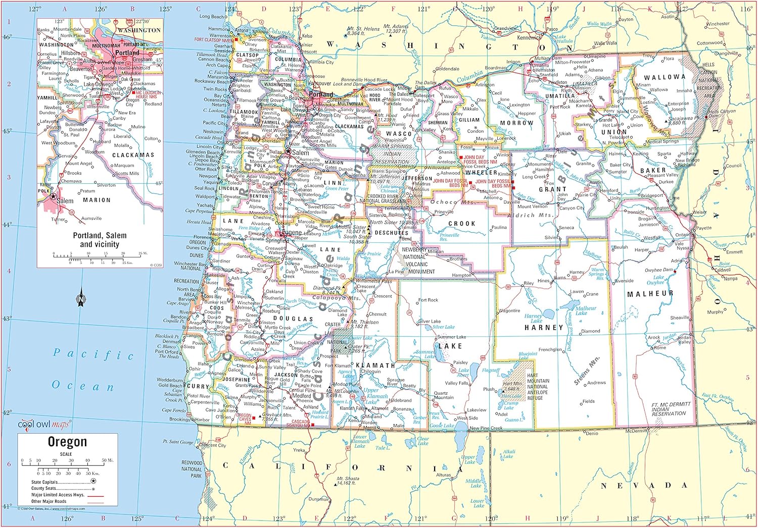
Cool Owl Maps Oregon State Wall Map Poster Rolled (Paper 34"x24")
Maps - Cool Owl Maps Oregon State Wall Map Poster Rolled (Paper 34"x24")

Cool Owl Maps Arizona State Wall Map Poster Rolled (Laminated 24"x30")
Maps - Cool Owl Maps Arizona State Wall Map Poster Rolled (Laminated 24"x30")
 Maps - Landmass - 24 x 36 inches XL Scratch Off Map with Frame - Travel World Map Poster Print with Hanger Frame - World Capitals, Wall Art & a Great Gift for Travelers


