
Features
- Mapping data provided by IN State Dept of Transportation
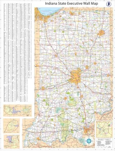
- Updated Edition
- Laminated for durability and dry-erase
- Large 36×54 Size
- Our top selling wall map of Indiana State
Details
Looking for the perfect wall map to showcase the beauty and precision of Indiana State? Look no further than our 36x54 Indiana State Official Executive Laminated Wall Map! Meticulously crafted using mapping data provided by the IN State Dept of Transportation, this updated edition is the epitome of accuracy and reliability.
What sets our wall map apart from the rest is its laminated finish. The lamination not only adds durability to the map, ensuring it will withstand the test of time, but it also provides a dry-erase surface. This means you can mark, highlight, and annotate the map with ease, making it a versatile tool whether you're using it for educational purposes or planning out your next adventure in Indiana.
Measuring an impressive 36x54 inches, our Indiana State Official Executive Wall Map guarantees clear and legible details. The large size allows you to easily identify and locate cities, towns, highways, and landmarks throughout the state. Whether you're a geography enthusiast, a classroom teacher, or a business owner looking to display your Indiana roots, this map is a must-have addition to your collection.
Join the ranks of countless satisfied customers who have made our Indiana State Official Executive Laminated Wall Map their top choice. Don't settle for lesser quality alternatives or outdated versions, invest in a map that is up-to-date and designed to impress. Take advantage of this opportunity today by ordering your very own Indiana State Official Executive Laminated Wall Map and discover the wonders of this great state!
Ready to elevate your Indiana State map game? Click here to purchase your very own Indiana State Official Executive Laminated Wall Map now!
Discover More Best Sellers in Maps
Shop Maps

USA Map for Kids - LAMINATED - United States Wall Chart Map (18" x 24")
 Maps - USA Map for Kids - LAMINATED - United States Wall Chart Map (18" x 24")

 Maps - National Parks Map Poster with 600+ NPS Site and USA Travel Destinations - Slate Edition (24W x 18H inches)
 Maps - Scratch Off Map of The United States Travel Map - Scratch Off USA Map by JTSC Products - Gifts for Travelers - Includes National Parks Landmarks Capital Cities Scratch map USA 17x24 in
 Maps - America The Beautiful USA Scratch Off Map- Interactive Travel Map - Scratch Off Poster Reveals Beautiful Nature Photography of Each 50 States - Travelers Gift - Traveler Wall Decor
 Maps - Map Your Travels Ballpark Travel Quest Scratch Off Map Print | Includes Gift Wrap Tube | Includes Scratch-Off Tool (18"x24")
 Maps - World Map Poster with Countries FLAGS For Kids (SMALL size13x19 World Map Laminated) Perfect World wall Map for School classroom or home

Cool Owl Maps North Carolina State Wall Map Poster Large Print Rolled 36"Wx18"H Paper
Maps - Cool Owl Maps North Carolina State Wall Map Poster Large Print Rolled 36"Wx18"H Paper

